 Camotes
Islands Map
Camotes
Islands Map
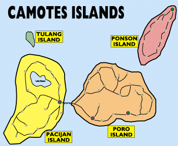
Camotes islands consist of four islands, Pacijan island, Poro island, Ponson island and a tiny Tulang island. Pacijan and Poro islands are actually joined together by paved road. Ponson island is separated by Camotes Sea, about 4 km northeast from Poro island. Tulang is located to the north of Pacijan. (see map)
Camotes
Islands Map
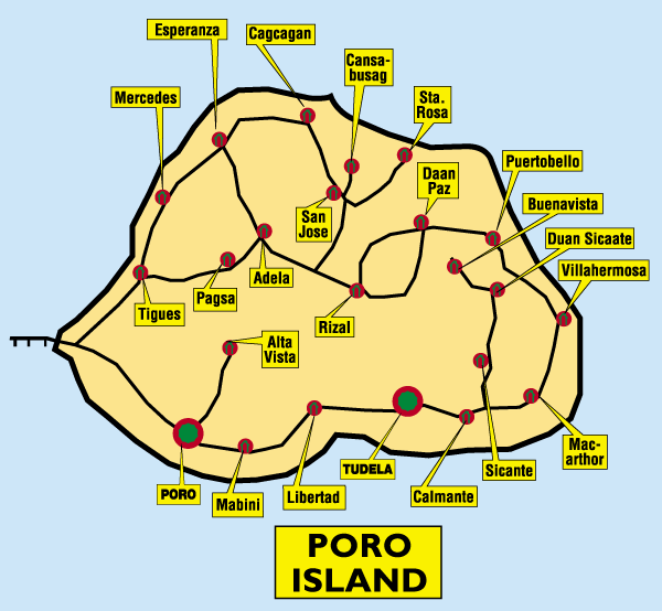
Tudela, Poro, San Francisco and Pilar are four largest
settlements on Camotes. Majority of houses are built near the seashore
alongside roads that circle all three islands. Some houses are scattered
in the island's interior.
Motorcycles are used as the main means of transport on Camotes islands,
unlike tricycles which are used throughout Philippines for people transport
over short distances. Camotes have only narrow trails to many places that
are accessible to two wheeled vehicles only.
Camotes islands have a small airport, however, most
of transport to and from the islands is serviced by sea transport. Polynesian
like style boats with two outriggers are used for transport of people and
cargo from Danao on Cebu island and from Ormoc City. These open boats are
called "pamboat" and they are a real thrill to ride when the weather is
nice.
The totally enclosed speed boat "Ocean Spray" is running to Cebu
City and back to Camotes a few times per day. Ocean Spray boat departs
from Pier-1 in Cebu and lands in Poro. Some people use this boat for commuting
to work in Cebu because there is not much industry in Camotes islands.
For more information and many beautiful pictures about Camotes Islands please visit the excellent web site of Mr. Ernst Falch CAMOTES ISLANDS Mr. Falch also created the maps I am using on my web pages.
For more pictures and info about Camotes Islands visit: Ming's Magic Place
Return to Table
of Contents